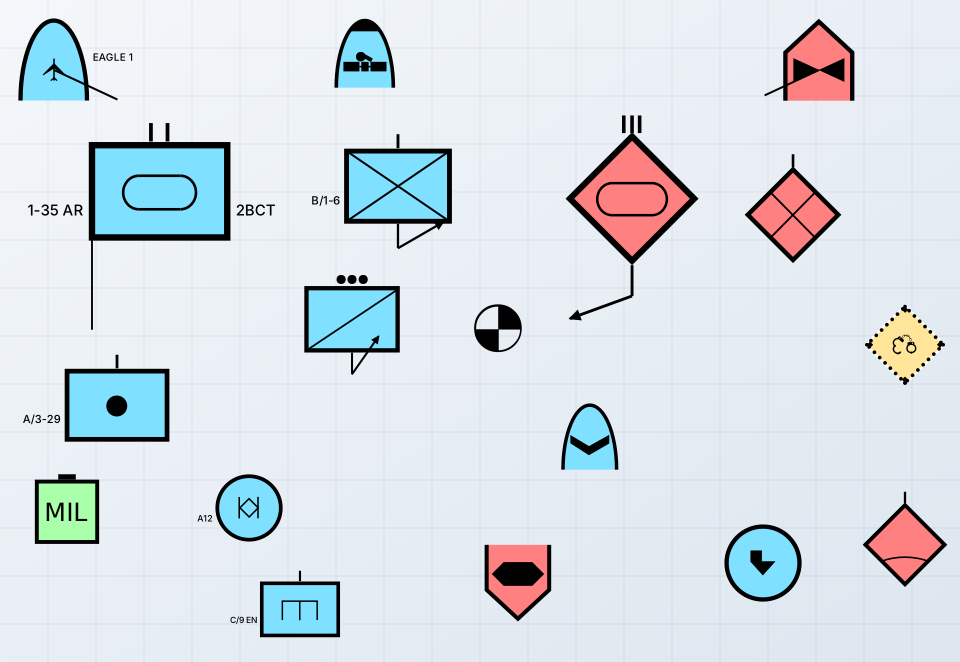
Military Symbols
Every single-point symbol of MIL-STD-2525E, 2525D, 2525C and 2525B, and APP-6(B): units, equipment, installations, activities and point control measures, with every amplifier the standard places. As SVG, a canvas or on a map.
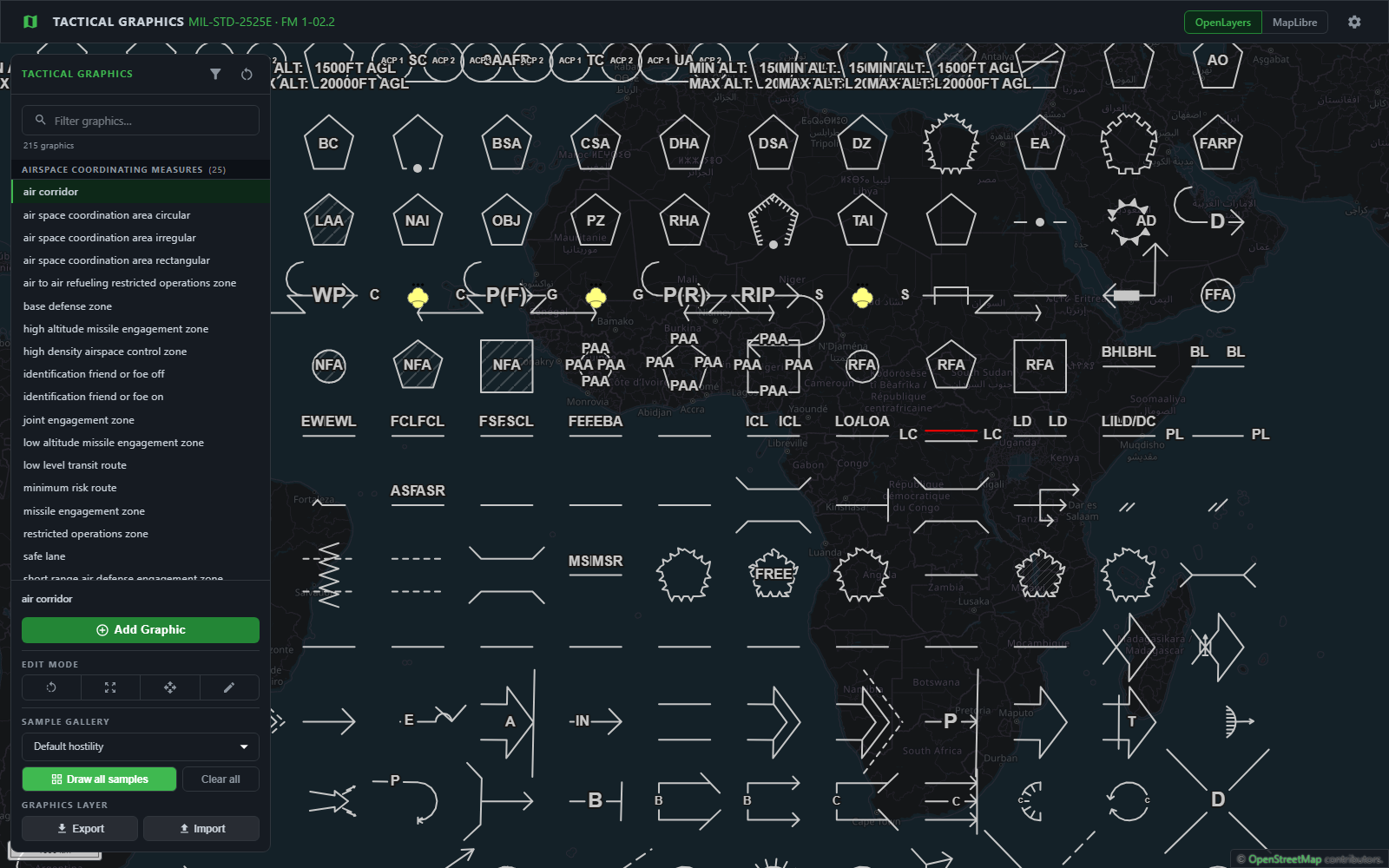
Zaes builds the symbology a mission map needs, each drawn from its own standard: unit and equipment symbols, the tactical graphics drawn around them, and weather and ocean graphics. Every library saves plain GeoJSON, displays on OpenLayers and MapLibre, and edits with the same editor. The libraries are free under the MIT license; commercial add-ons take them to Cesium, TAK and ArcGIS.
Each library owns its standard and nothing else, so a program takes the ones its maps need, and they draw together on one map.
Every single-point symbol of MIL-STD-2525E, 2525D, 2525C and 2525B, and APP-6(B): units, equipment, installations, activities and point control measures, with every amplifier the standard places. As SVG, a canvas or on a map.
The control measures drawn from several points: axes of advance, phase lines, boundaries, areas, mission tasks and range fans, editable on the map, with a unit symbol at the center of the six graphics that carry one.
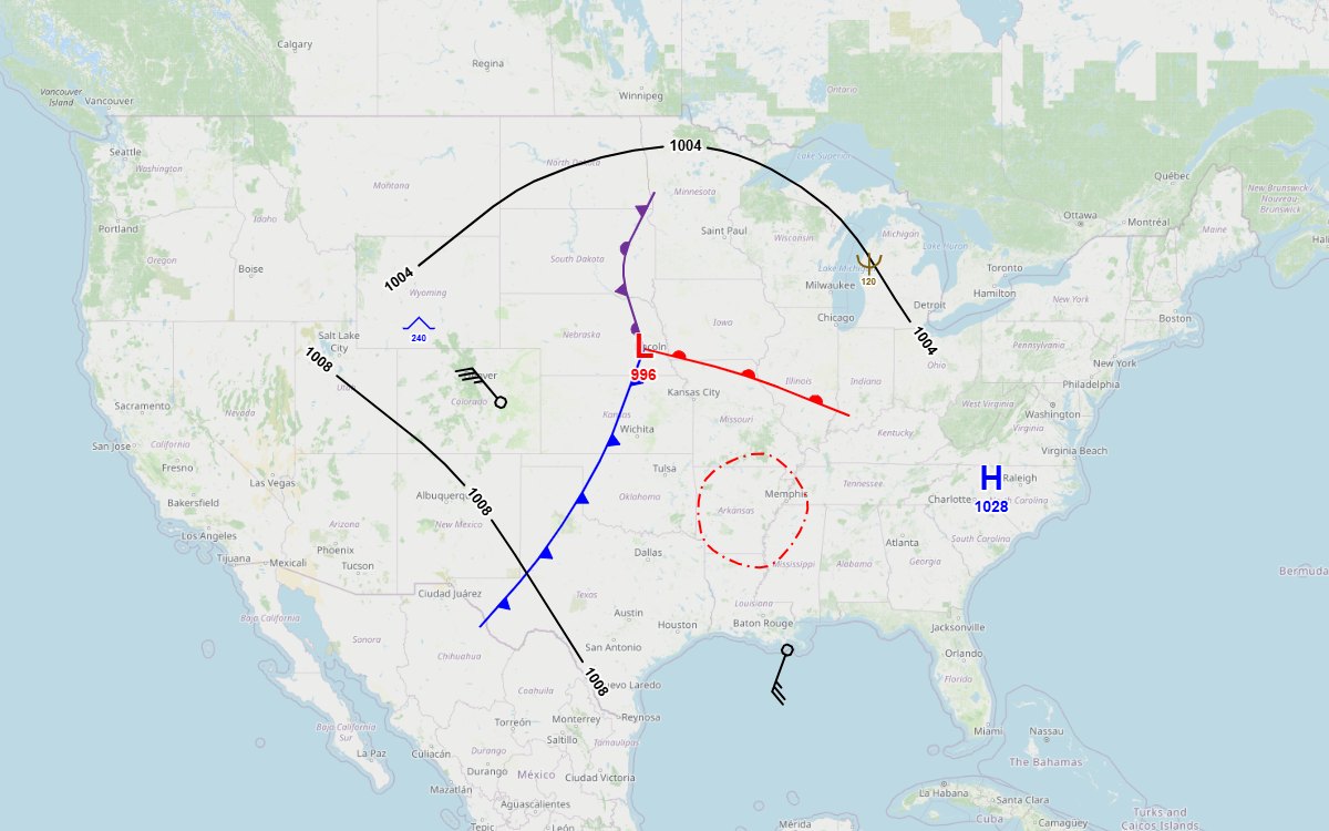
Every weather and ocean graphic of 2525E Appendix M, and the IHO S-412 marine weather warnings and S-411 ice charts: fronts, isobars, wind barbs, station plots, ice, depth and mine warfare bottom descriptors.
The libraries share an open source drawing engine and editor, @zaes/symbology-engine and @zaes/symbology-editor, both MIT on npm. Each library supplies what its standard says; the engine draws it the same way on every map.
A symbol or graphic is one feature with its points and its properties. Nothing about the view is saved, so a file opens the same on any map.
OpenLayers and MapLibre in the open source libraries, flat or tilted over terrain; Cesium through an add-on. The core needs no map library, so it runs in Node or a worker too.
Draw, select, move, reshape, resize, rotate, undo and redo, with the same gestures in every library and on every map.
The libraries meet where the standards do: a security operation's tactical graphic carries the unit symbol the military symbols library draws, through a provider either side can swap.
Commercial add-ons from Zaes take a library's graphics, and the same saved files, onto a 3D globe, into TAK and into ArcGIS. They are licensed by contract, separately from the MIT libraries, and each library's page lists its own.
Graphics draped over terrain and 3D Tiles, point symbols upright on leader lines, and the same editor as the 2D maps. For Tactical Graphics and METOC.
Cursor on Target for every TAK client, WinTAK and ATAK plugins that draw the graphics exactly, data packages and live TAK Server sync. For Tactical Graphics and METOC.
Tactical graphics in the ArcGIS Maps SDK for JavaScript. Military symbols place on ArcGIS maps from the open source library itself.
NVG and C2SIM exchange for tactical graphics, and official weather analyses and observations as METOC graphics.
Every library is free under the MIT license, documented, and has a live sample to try in the browser.