Graphics
The catalog holds 408 graphics: the 353 that MIL-STD-2525E Change 1, Appendix M draws in symbol sets 45 (Atmospheric) and 46 (Oceanographic), each with its entity code, plus the wind barb (Table M-I's draw rule) and the station plot, which have none. Each row is generated from the package itself, and each thumbnail is drawn by metocThumbnailSvg, the same paint layer the map uses.
The visual catalog shows them larger, with search.
Symbol set 45: Atmospheric
Pressure centers
| Graphic | Name | Entity | Geometry | SIDC | |
|---|---|---|---|---|---|
 | Low Pressure Center | LowPressureCenter | 110100 | Point | 150045000011010000000000000000 |
 | Cyclone Center | CycloneCenter | 110101 | Point | 150045000011010100000000000000 |
 | Tropopause Low | TropopauseLow | 110102 | Point | 150045000011010200000000000000 |
 | High Pressure Center | HighPressureCenter | 110200 | Point | 150045000011020000000000000000 |
 | Anticyclone Center | AnticycloneCenter | 110201 | Point | 150045000011020100000000000000 |
 | Tropopause High | TropopauseHigh | 110202 | Point | 150045000011020200000000000000 |
Fronts
| Graphic | Name | Entity | Geometry | SIDC | |
|---|---|---|---|---|---|
 | Cold Front | ColdFront | 110301 | Line | 150045000011030100000000000000 |
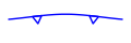 | Upper Cold Front | UpperColdFront | 110302 | Line | 150045000011030200000000000000 |
 | Cold Frontogenesis | ColdFrontogenesis | 110303 | Line | 150045000011030300000000000000 |
 | Cold Frontolysis | ColdFrontolysis | 110304 | Line | 150045000011030400000000000000 |
 | Warm Front | WarmFront | 110305 | Line | 150045000011030500000000000000 |
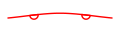 | Upper Warm Front | UpperWarmFront | 110306 | Line | 150045000011030600000000000000 |
 | Warm Frontogenesis | WarmFrontogenesis | 110307 | Line | 150045000011030700000000000000 |
 | Warm Frontolysis | WarmFrontolysis | 110308 | Line | 150045000011030800000000000000 |
 | Occluded Front | OccludedFront | 110309 | Line | 150045000011030900000000000000 |
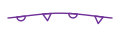 | Upper Occluded Front | UpperOccludedFront | 110310 | Line | 150045000011031000000000000000 |
 | Occluded Frontolysis | OccludedFrontolysis | 110311 | Line | 150045000011031100000000000000 |
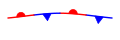 | Stationary Front | StationaryFront | 110312 | Line | 150045000011031200000000000000 |
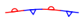 | Upper Stationary Front | UpperStationaryFront | 110313 | Line | 150045000011031300000000000000 |
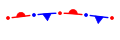 | Stationary Frontogenesis | StationaryFrontogenesis | 110314 | Line | 150045000011031400000000000000 |
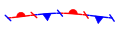 | Stationary Frontolysis | StationaryFrontolysis | 110315 | Line | 150045000011031500000000000000 |
Pressure lines
| Graphic | Name | Entity | Geometry | SIDC | |
|---|---|---|---|---|---|
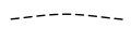 | Trough Axis | TroughAxis | 110401 | Line | 150045000011040100000000000000 |
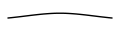 | Trough | Trough | 110402 | Line | 150045000011040200000000000000 |
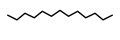 | Ridge Axis | RidgeAxis | 110403 | Line | 150045000011040300000000000000 |
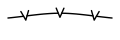 | Severe Squall Line | SevereSquallLine | 110404 | Line | 150045000011040400000000000000 |
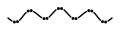 | Instability Line | InstabilityLine | 110405 | Line | 150045000011040500000000000000 |
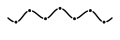 | Shear Line | ShearLine | 110406 | Line | 150045000011040600000000000000 |
 | Inter-Tropical Convergence Zone | InterTropicalConvergenceZone | 110407 | Area | 150045000011040700000000000000 |
 | Convergence Line | ConvergenceLine | 110408 | Line | 150045000011040800000000000000 |
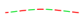 | Inter-Tropical Discontinuity | InterTropicalDiscontinuity | 110409 | Line | 150045000011040900000000000000 |
Winds
| Graphic | Name | Entity | Geometry | SIDC | |
|---|---|---|---|---|---|
 | Calm Winds | CalmWinds | 140100 | Point | 150045000014010000000000000000 |
 | Wind Barb | WindBarb | — | Point | none |
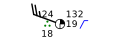 | Station Plot | StationPlot | — | Point | none |
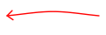 | Jet Stream | JetStream | 140300 | Line | 150045000014030000000000000000 |
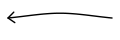 | Stream Line | StreamLine | 140400 | Line | 150045000014040000000000000000 |
Isopleths
| Graphic | Name | Entity | Geometry | SIDC | |
|---|---|---|---|---|---|
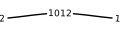 | Isobar - Surface | IsobarSurface | 180100 | Line | 150045000018010000000000000000 |
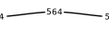 | Contour - Upper Air | ContourUpperAir | 180200 | Line | 150045000018020000000000000000 |
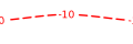 | Isotherm | Isotherm | 180300 | Line | 150045000018030000000000000000 |
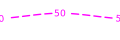 | Isotach | Isotach | 180400 | Line | 150045000018040000000000000000 |
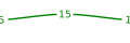 | Isodrosotherm | Isodrosotherm | 180500 | Line | 150045000018050000000000000000 |
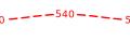 | Thickness | Thickness | 180600 | Line | 150045000018060000000000000000 |
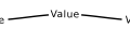 | Operator-Defined Freeform Line | OperatorDefinedFreeformLine | 180700 | Line | 150045000018070000000000000000 |
Areas of weather
| Graphic | Name | Entity | Geometry | SIDC | |
|---|---|---|---|---|---|
 | Tropical Storm Wind Areas and Date/Time Labels | TropicalStormWindArea | 162004 | Area | 150045000016200400000000000000 |
 | Instrument Flight Rule (IFR) | InstrumentFlightRule | 170100 | Area | 150045000017010000000000000000 |
 | Marginal Visual Flight Rule (MVFR) | MarginalVisualFlightRule | 170200 | Area | 150045000017020000000000000000 |
 | Turbulence | Turbulence | 170300 | Area | 150045000017030000000000000000 |
 | Icing | Icing | 170400 | Area | 150045000017040000000000000000 |
 | Liquid Precipitation - Non-Convective Continuous or Intermittent | LiquidPrecipitation | 170500 | Area | 150045000017050000000000000000 |
 | Liquid Precipitation - Convective | ConvectivePrecipitation | 170501 | Area | 150045000017050100000000000000 |
 | Freezing/Frozen Precipitation | FreezingPrecipitation | 170600 | Area | 150045000017060000000000000000 |
 | Thunderstorm | Thunderstorm | 170700 | Area | 150045000017070000000000000000 |
 | Fog | Fog | 170800 | Area | 150045000017080000000000000000 |
 | Dust or Sand | DustOrSand | 170900 | Area | 150045000017090000000000000000 |
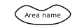 | Operator-Defined Freeform Area | OperatorDefinedFreeformArea | 171000 | Area | 150045000017100000000000000000 |
Pressure tendency
| Graphic | Name | Entity | Geometry | SIDC | |
|---|---|---|---|---|---|
 | Pressure Tendency - Rise Then Fall Higher | PressureRiseThenFallHigher | 110501 | Point | 150045000011050100000000000000 |
 | Pressure Tendency - Rise Then Steady | PressureRiseThenSteady | 110502 | Point | 150045000011050200000000000000 |
 | Pressure Tendency - Rise | PressureRise | 110503 | Point | 150045000011050300000000000000 |
 | Pressure Tendency - Rise Then Rise Higher | PressureRiseThenRiseHigher | 110504 | Point | 150045000011050400000000000000 |
 | Pressure Tendency - Steady | PressureSteady | 110505 | Point | 150045000011050500000000000000 |
 | Pressure Tendency - Fall Then Rise Lower | PressureFallThenRiseLower | 110506 | Point | 150045000011050600000000000000 |
 | Pressure Tendency - Fall Then Steady | PressureFallThenSteady | 110507 | Point | 150045000011050700000000000000 |
 | Pressure Tendency - Fall | PressureFall | 110508 | Point | 150045000011050800000000000000 |
 | Pressure Tendency - Rise Then Fall Lower | PressureRiseThenFallLower | 110509 | Point | 150045000011050900000000000000 |
Turbulence and icing
| Graphic | Name | Entity | Geometry | SIDC | |
|---|---|---|---|---|---|
 | Turbulence - Light | TurbulenceLight | 120100 | Point | 150045000012010000000000000000 |
 | Turbulence - Moderate | TurbulenceModerate | 120200 | Point | 150045000012020000000000000000 |
 | Turbulence - Severe | TurbulenceSevere | 120300 | Point | 150045000012030000000000000000 |
 | Turbulence - Extreme | TurbulenceExtreme | 120400 | Point | 150045000012040000000000000000 |
 | Turbulence - Mountain Waves | TurbulenceMountainWaves | 120500 | Point | 150045000012050000000000000000 |
 | Clear Icing - Light | IcingClearLight | 130101 | Point | 150045000013010100000000000000 |
 | Rime Icing - Light | IcingRimeLight | 130201 | Point | 150045000013020100000000000000 |
 | Mixed Icing - Light | IcingMixedLight | 130301 | Point | 150045000013030100000000000000 |
 | Clear Icing - Moderate | IcingClearModerate | 130102 | Point | 150045000013010200000000000000 |
 | Rime Icing - Moderate | IcingRimeModerate | 130202 | Point | 150045000013020200000000000000 |
 | Mixed Icing - Moderate | IcingMixedModerate | 130302 | Point | 150045000013030200000000000000 |
 | Clear Icing - Severe | IcingClearSevere | 130103 | Point | 150045000013010300000000000000 |
 | Rime Icing - Severe | IcingRimeSevere | 130203 | Point | 150045000013020300000000000000 |
 | Mixed Icing - Severe | IcingMixedSevere | 130303 | Point | 150045000013030300000000000000 |
Cloud cover
| Graphic | Name | Entity | Geometry | SIDC | |
|---|---|---|---|---|---|
 | Cloud Coverage - Clear Sky | CloudClearSky | 150101 | Point | 150045000015010100000000000000 |
 | Cloud Coverage - Few Coverage | CloudFew | 150102 | Point | 150045000015010200000000000000 |
 | Cloud Coverage - Scattered Coverage | CloudScattered | 150103 | Point | 150045000015010300000000000000 |
 | Cloud Coverage - Broken Coverage | CloudBroken | 150104 | Point | 150045000015010400000000000000 |
 | Cloud Coverage - Overcast Coverage | CloudOvercast | 150105 | Point | 150045000015010500000000000000 |
 | Cloud Coverage - Sky Totally or Partially Obscured | CloudSkyObscured | 150106 | Point | 150045000015010600000000000000 |
Weather
| Graphic | Name | Entity | Geometry | SIDC | |
|---|---|---|---|---|---|
 | Rain - Intermittent Light | RainIntermittentLight | 160101 | Point | 150045000016010100000000000000 |
 | Rain - Continuous Light | RainContinuousLight | 160102 | Point | 150045000016010200000000000000 |
 | Rain - Intermittent Moderate | RainIntermittentModerate | 160103 | Point | 150045000016010300000000000000 |
 | Rain - Intermittent Moderate/Continuous Moderate | RainContinuousModerate | 160104 | Point | 150045000016010400000000000000 |
 | Rain - Intermittent Heavy | RainIntermittentHeavy | 160105 | Point | 150045000016010500000000000000 |
 | Rain - Intermittent Heavy/Continuous Heavy | RainContinuousHeavy | 160106 | Point | 150045000016010600000000000000 |
 | Freezing Rain - Light | FreezingRainLight | 160201 | Point | 150045000016020100000000000000 |
 | Freezing Rain - Moderate/Heavy | FreezingRainModerateHeavy | 160202 | Point | 150045000016020200000000000000 |
 | Rain Showers - Light | RainShowersLight | 160301 | Point | 150045000016030100000000000000 |
 | Rain Showers - Moderate/Heavy | RainShowersModerateHeavy | 160302 | Point | 150045000016030200000000000000 |
 | Rain Showers - Torrential | RainShowersTorrential | 160303 | Point | 150045000016030300000000000000 |
 | Drizzle - Intermittent Light | DrizzleIntermittentLight | 160401 | Point | 150045000016040100000000000000 |
 | Drizzle - Intermittent Light/Continuous Light | DrizzleContinuousLight | 160402 | Point | 150045000016040200000000000000 |
 | Drizzle - Intermittent Moderate | DrizzleIntermittentModerate | 160403 | Point | 150045000016040300000000000000 |
 | Drizzle - Intermittent Moderate/Continuous Moderate | DrizzleContinuousModerate | 160404 | Point | 150045000016040400000000000000 |
 | Drizzle - Intermittent Heavy | DrizzleIntermittentHeavy | 160405 | Point | 150045000016040500000000000000 |
 | Drizzle - Intermittent Heavy/Continuous Heavy | DrizzleContinuousHeavy | 160406 | Point | 150045000016040600000000000000 |
 | Freezing Drizzle - Light | FreezingDrizzleLight | 160501 | Point | 150045000016050100000000000000 |
 | Freezing Drizzle - Moderate/Heavy | FreezingDrizzleModerateHeavy | 160502 | Point | 150045000016050200000000000000 |
 | Rain or Drizzle and Snow - Light | RainOrDrizzleAndSnowLight | 160601 | Point | 150045000016060100000000000000 |
 | Rain or Drizzle and Snow - Moderate/Heavy | RainOrDrizzleAndSnowModerateHeavy | 160602 | Point | 150045000016060200000000000000 |
 | Rain and Snow Showers - Light | RainAndSnowShowersLight | 160603 | Point | 150045000016060300000000000000 |
 | Rain and Snow Showers - Moderate/Heavy | RainAndSnowShowersModerateHeavy | 160604 | Point | 150045000016060400000000000000 |
 | Snow - Intermittent Light | SnowIntermittentLight | 160701 | Point | 150045000016070100000000000000 |
 | Snow - Intermittent Light/Continuous Light | SnowContinuousLight | 160702 | Point | 150045000016070200000000000000 |
 | Snow - Intermittent Moderate | SnowIntermittentModerate | 160703 | Point | 150045000016070300000000000000 |
 | Snow - Intermittent Moderate/Continuous Moderate | SnowContinuousModerate | 160704 | Point | 150045000016070400000000000000 |
 | Snow - Intermittent Heavy | SnowIntermittentHeavy | 160705 | Point | 150045000016070500000000000000 |
 | Snow - Intermittent Heavy/Continuous Heavy | SnowContinuousHeavy | 160706 | Point | 150045000016070600000000000000 |
 | Blowing Snow - Light/Moderate | BlowingSnowLightModerate | 160707 | Point | 150045000016070700000000000000 |
 | Blowing Snow - Heavy | BlowingSnowHeavy | 160708 | Point | 150045000016070800000000000000 |
 | Snow Grains | SnowGrains | 160800 | Point | 150045000016080000000000000000 |
 | Snow Showers - Light | SnowShowersLight | 160901 | Point | 150045000016090100000000000000 |
 | Snow Showers - Moderate/Heavy | SnowShowersModerateHeavy | 160902 | Point | 150045000016090200000000000000 |
 | Hail - Light, Not Associated with Thunder | HailLight | 161001 | Point | 150045000016100100000000000000 |
 | Hail - Moderate/Heavy, Not Associated with Thunder | HailModerateHeavy | 161002 | Point | 150045000016100200000000000000 |
 | Ice Crystals (Diamond Dust) | IceCrystals | 161100 | Point | 150045000016110000000000000000 |
 | Ice Pellets (Sleet) - Light | IcePelletsLight | 161201 | Point | 150045000016120100000000000000 |
 | Ice Pellets (Sleet) - Moderate | IcePelletsModerate | 161202 | Point | 150045000016120200000000000000 |
 | Ice Pellets (Sleet) - Heavy | IcePelletsHeavy | 161203 | Point | 150045000016120300000000000000 |
 | Inversion | Inversion | 161300 | Point | 150045000016130000000000000000 |
 | Fog - Shallow Patches | FogShallowPatches | 161501 | Point | 150045000016150100000000000000 |
 | Fog - Shallow Continuous | FogShallowContinuous | 161502 | Point | 150045000016150200000000000000 |
 | Fog - Patchy | FogPatchy | 161503 | Point | 150045000016150300000000000000 |
 | Fog - Sky Visible | FogSkyVisible | 161504 | Point | 150045000016150400000000000000 |
 | Fog - Sky Obscured | FogSkyObscured | 161505 | Point | 150045000016150500000000000000 |
 | Fog - Freezing, Sky Visible | FreezingFogSkyVisible | 161506 | Point | 150045000016150600000000000000 |
 | Fog - Freezing, Sky Obscured | FreezingFogSkyObscured | 161507 | Point | 150045000016150700000000000000 |
 | Mist | Mist | 161600 | Point | 150045000016160000000000000000 |
 | Smoke | Smoke | 161700 | Point | 150045000016170000000000000000 |
 | Haze | Haze | 161800 | Point | 150045000016180000000000000000 |
 | Dust or Sand - Light to Moderate | DustOrSandLightModerate | 161901 | Point | 150045000016190100000000000000 |
 | Dust or Sand - Severe | DustOrSandSevere | 161902 | Point | 150045000016190200000000000000 |
 | Dust or Sand - Dust Devil | DustDevil | 161903 | Point | 150045000016190300000000000000 |
 | Dust or Sand - Blowing Dust or Sand | BlowingDustOrSand | 161904 | Point | 150045000016190400000000000000 |
 | Precipitation of Unknown Type and Intensity | PrecipitationUnknown | 162400 | Point | 150045000016240000000000000000 |
Storms and tropical systems
| Graphic | Name | Entity | Geometry | SIDC | |
|---|---|---|---|---|---|
 | Thunderstorm - No Precipitation | ThunderstormNoPrecipitation | 161401 | Point | 150045000016140100000000000000 |
 | Thunderstorm Light to Moderate with Rain/Snow - No Hail | ThunderstormLightModerateRainSnow | 161402 | Point | 150045000016140200000000000000 |
 | Thunderstorm Heavy with Rain/Snow - No Hail | ThunderstormHeavyRainSnow | 161403 | Point | 150045000016140300000000000000 |
 | Thunderstorm Light to Moderate - with Hail | ThunderstormLightModerateHail | 161404 | Point | 150045000016140400000000000000 |
 | Thunderstorm Heavy - with Hail | ThunderstormHeavyHail | 161405 | Point | 150045000016140500000000000000 |
 | Funnel Cloud (Tornado/Waterspout) | FunnelCloud | 161406 | Point | 150045000016140600000000000000 |
 | Squall | Squall | 161407 | Point | 150045000016140700000000000000 |
 | Lightning | Lightning | 161408 | Point | 150045000016140800000000000000 |
 | Tropical Depression | TropicalDepression | 162001 | Point | 150045000016200100000000000000 |
 | Tropical Storm | TropicalStorm | 162002 | Point | 150045000016200200000000000000 |
 | Hurricane/Typhoon | HurricaneTyphoon | 162003 | Point | 150045000016200300000000000000 |
 | Volcanic Eruption | VolcanicEruption | 162100 | Point | 150045000016210000000000000000 |
 | Volcanic Ash | VolcanicAsh | 162101 | Point | 150045000016210100000000000000 |
 | Tropopause Level | TropopauseLevel | 162200 | Point | 150045000016220000000000000000 |
 | Freezing Level | FreezingLevel | 162300 | Point | 150045000016230000000000000000 |
State of the ground
| Graphic | Name | Entity | Geometry | SIDC | |
|---|---|---|---|---|---|
 | Surface Dry Without Cracks or Appreciable Dust or Loose Sand | GroundDry | 190101 | Point | 150045000019010100000000000000 |
 | Surface Moist | GroundMoist | 190102 | Point | 150045000019010200000000000000 |
 | Surface Wet, Standing Water in Small or Large Pools | GroundWet | 190103 | Point | 150045000019010300000000000000 |
 | Surface Flooded | GroundFlooded | 190104 | Point | 150045000019010400000000000000 |
 | Surface Frozen | GroundFrozen | 190105 | Point | 150045000019010500000000000000 |
 | Glaze (Thin Ice) on Ground | GroundGlaze | 190106 | Point | 150045000019010600000000000000 |
 | Loose Dry Dust or Sand not Covering Ground Completely | GroundLooseDustNotCovering | 190107 | Point | 150045000019010700000000000000 |
 | Thin Loose Dry Dust or Sand Covering Ground Completely | GroundThinLooseDust | 190108 | Point | 150045000019010800000000000000 |
 | Moderate/Thick Loose Dry Dust or Sand Covering Ground Completely | GroundThickLooseDust | 190109 | Point | 150045000019010900000000000000 |
 | Extremely Dry with Cracks | GroundExtremelyDry | 190110 | Point | 150045000019011000000000000000 |
 | Predominately Ice Covered | GroundPredominantlyIce | 190201 | Point | 150045000019020100000000000000 |
 | Compact or Wet Snow (with or without Ice) Covering Less Than One-Half of Ground | GroundCompactSnowLessHalf | 190202 | Point | 150045000019020200000000000000 |
 | Compact or Wet Snow (with or without Ice) Covering at Least One-Half of Ground, but Ground not Completely Covered | GroundCompactSnowAtLeastHalf | 190203 | Point | 150045000019020300000000000000 |
 | Even Layer of Compact or Wet Snow Covering Ground Completely | GroundCompactSnowEven | 190204 | Point | 150045000019020400000000000000 |
 | Uneven Layer of Compact or Wet Snow Covering Ground Completely | GroundCompactSnowUneven | 190205 | Point | 150045000019020500000000000000 |
 | Loose Dry Snow Covering Less Than One-Half of Ground | GroundLooseSnowLessHalf | 190206 | Point | 150045000019020600000000000000 |
 | Loose Dry Snow Covering at least One-Half of Ground, but Ground not Completely Covered | GroundLooseSnowAtLeastHalf | 190207 | Point | 150045000019020700000000000000 |
 | Even Layer of Loose Dry Snow Covering Ground Completely | GroundLooseSnowEven | 190208 | Point | 150045000019020800000000000000 |
 | Uneven Layer of Loose Dry Snow Covering Ground Completely | GroundLooseSnowUneven | 190209 | Point | 150045000019020900000000000000 |
 | Snow Covering Ground Completely, Deep Drifts | GroundSnowDeepDrifts | 190210 | Point | 150045000019021000000000000000 |
Marine weather warnings (S-412)
| Graphic | Name | Entity | Geometry | SIDC | |
|---|---|---|---|---|---|
 | Wind Warning - Near Gale Force | S412WindWarningNearGale | — | Area | none |
 | Wind Warning - Gale Force | S412WindWarningGale | — | Area | none |
 | Wind Warning - Storm Force | S412WindWarningStorm | — | Area | none |
 | Wind Warning - Hurricane Force | S412WindWarningHurricane | — | Area | none |
 | Restricted Visibility Warning | S412RestrictedVisibility | — | Area | none |
 | Thunderstorm Warning | S412Thunderstorm | — | Area | none |
Symbol set 46: Oceanographic
Ice
| Graphic | Name | Entity | Geometry | SIDC | |
|---|---|---|---|---|---|
 | Icebergs - Many Icebergs | ManyIcebergs | 110101 | Point | 150046000011010100000000000000 |
 | Icebergs - Belts and Strips | IcebergBeltsStrips | 110102 | Point | 150046000011010200000000000000 |
 | Icebergs - General | IcebergGeneral | 110103 | Point | 150046000011010300000000000000 |
 | Icebergs - Many Icebergs, General | ManyIcebergsGeneral | 110104 | Point | 150046000011010400000000000000 |
 | Icebergs - Bergy Bit | BergyBit | 110105 | Point | 150046000011010500000000000000 |
 | Icebergs - Many Bergy Bits | ManyBergyBits | 110106 | Point | 150046000011010600000000000000 |
 | Icebergs - Growler | Growler | 110107 | Point | 150046000011010700000000000000 |
 | Icebergs - Many Growlers | ManyGrowlers | 110108 | Point | 150046000011010800000000000000 |
 | Icebergs - Floeberg | Floeberg | 110109 | Point | 150046000011010900000000000000 |
 | Icebergs - Ice Island | IceIsland | 110110 | Point | 150046000011011000000000000000 |
 | Ice Concentration - Bergy Water | BergyWater | 110201 | Point | 150046000011020100000000000000 |
 | Ice Concentration - Water with Radar Targets | WaterWithRadarTargets | 110202 | Point | 150046000011020200000000000000 |
 | Ice Concentration - Ice Free | IceFree | 110203 | Point | 150046000011020300000000000000 |
 | Dynamic Processes - Convergence | IceConvergence | 110301 | Point | 150046000011030100000000000000 |
 | Dynamic Processes - Divergence | IceDivergence | 110302 | Point | 150046000011030200000000000000 |
 | Dynamic Processes - Shearing or Shear Zone | IceShearing | 110303 | Point | 150046000011030300000000000000 |
 | Dynamic Processes - Ice Drift (Direction) | IceDrift | 110304 | Point | 150046000011030400000000000000 |
 | Sea Ice | SeaIce | 110400 | Point | 150046000011040000000000000000 |
 | Sea Ice - Ice Thickness (Observed) | IceThicknessObserved | 110401 | Point | 150046000011040100000000000000 |
 | Sea Ice - Ice Thickness (Estimated) | IceThicknessEstimated | 110402 | Point | 150046000011040200000000000000 |
 | Sea Ice - Melt Puddles or Flooded Ice | MeltPuddles | 110403 | Point | 150046000011040300000000000000 |
 | Snow Cover | SnowCover | 110700 | Point | 150046000011070000000000000000 |
 | Snow Cover - Sastrugi (with Orientation) | Sastrugi | 110701 | Point | 150046000011070100000000000000 |
 | Topographical Features - Ridges or Hummocks | RidgesHummocks | 110801 | Point | 150046000011080100000000000000 |
 | Topographical Features - Rafting | Rafting | 110802 | Point | 150046000011080200000000000000 |
 | Topographical Features - Jammed Brash Barrier | JammedBrashBarrier | 110803 | Point | 150046000011080300000000000000 |
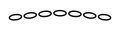 | Limits - Limits of Visual Observation | LimitsVisualObservation | 110501 | Line | 150046000011050100000000000000 |
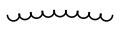 | Limits - Limits of Undercast | LimitsUndercast | 110502 | Line | 150046000011050200000000000000 |
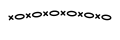 | Limits - Limits of Radar Observation | LimitsRadarObservation | 110503 | Line | 150046000011050300000000000000 |
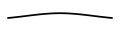 | Limits - Observed Ice Edge or Boundary | ObservedIceEdge | 110504 | Line | 150046000011050400000000000000 |
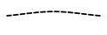 | Limits - Estimated Ice Edge or Boundary | EstimatedIceEdge | 110505 | Line | 150046000011050500000000000000 |
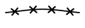 | Limits - Ice Edge or Boundary From Radar | IceEdgeFromRadar | 110506 | Line | 150046000011050600000000000000 |
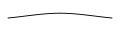 | Openings in the Ice - Cracks | IceCracks | 110601 | Line | 150046000011060100000000000000 |
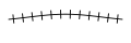 | Openings in the Ice - Cracks at a Specific Location | IceCracksSpecific | 110602 | Line | 150046000011060200000000000000 |
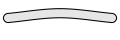 | Openings in the Ice - Lead | IceLead | 110603 | Line | 150046000011060300000000000000 |
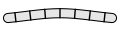 | Openings in the Ice - Frozen Lead | IceFrozenLead | 110604 | Line | 150046000011060400000000000000 |
Depth and coast
| Graphic | Name | Entity | Geometry | SIDC | |
|---|---|---|---|---|---|
 | Depth - Soundings | Soundings | 120101 | Point | 150046000012010100000000000000 |
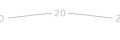 | Depth - Depth Curve | DepthCurve | 120102 | Line | 150046000012010200000000000000 |
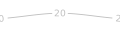 | Depth - Depth Contour | DepthContour | 120103 | Line | 150046000012010300000000000000 |
 | Depth - Depth Area | DepthArea | 120104 | Area | 150046000012010400000000000000 |
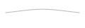 | Coastal Hydrography - Coastline | Coastline | 120201 | Line | 150046000012020100000000000000 |
 | Coastal Hydrography - Island | Island | 120202 | Area | 150046000012020200000000000000 |
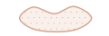 | Coastal Hydrography - Beach | Beach | 120203 | Area | 150046000012020300000000000000 |
 | Coastal Hydrography - Water | Water | 120204 | Area | 150046000012020400000000000000 |
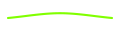 | Coastal Hydrography - Foreshore - Line | ForeshoreLine | 120205 | Line | 150046000012020500000000000000 |
 | Coastal Hydrography - Foreshore - Area | ForeshoreArea | 120206 | Area | 150046000012020600000000000000 |
Ports and harbors
| Graphic | Name | Entity | Geometry | SIDC | |
|---|---|---|---|---|---|
 | Ports - Berths (Onshore) | BerthsOnshore | 120302 | Point | 150046000012030200000000000000 |
 | Ports - Berths (Anchor) | BerthsAnchor | 120303 | Point | 150046000012030300000000000000 |
 | Ports - Anchorage - Point | AnchoragePoint | 120304 | Point | 150046000012030400000000000000 |
 | Ports - Call In Point | CallInPoint | 120307 | Point | 150046000012030700000000000000 |
 | Ports and Harbors - Fishing Harbor - Point | FishingHarbor | 120309 | Point | 150046000012030900000000000000 |
 | Ports and Harbors - Fish Weirs - Point | FishWeirs | 120310 | Point | 150046000012031000000000000000 |
 | Ports and Harbors - Fish Stakes - Point | FishStakes | 120311 | Point | 150046000012031100000000000000 |
 | Facilities - Landing Place | LandingPlace | 120315 | Point | 150046000012031500000000000000 |
 | Facilities - Offshore Loading Facility - Point | OffshoreLoadingPoint | 120316 | Point | 150046000012031600000000000000 |
 | Facilities - Landing Ring | LandingRing | 120321 | Point | 150046000012032100000000000000 |
 | Facilities - Ferry Crossing | FerryCrossing | 120322 | Point | 150046000012032200000000000000 |
 | Facilities - Cable Ferry Crossing | CableFerryCrossing | 120323 | Point | 150046000012032300000000000000 |
 | Facilities - Dolphin | Dolphin | 120324 | Point | 150046000012032400000000000000 |
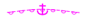 | Ports - Anchorage - Line | AnchorageLine | 120305 | Line | 150046000012030500000000000000 |
 | Ports - Anchorage - Area | AnchorageArea | 120306 | Area | 150046000012030600000000000000 |
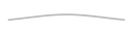 | Ports - Pier/Wharf/Quay | PierWharfQuay | 120308 | Line | 150046000012030800000000000000 |
 | Ports and Harbors - Fish Traps - Area | FishTrapsArea | 120312 | Area | 150046000012031200000000000000 |
 | Facilities - Drydock | Drydock | 120314 | Area | 150046000012031400000000000000 |
 | Facilities - Offshore Loading Facility - Line | OffshoreLoadingLine | 120317 | Line | 150046000012031700000000000000 |
 | Facilities - Offshore Loading Facility - Area | OffshoreLoadingArea | 120318 | Area | 150046000012031800000000000000 |
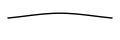 | Facilities - Ramp - Above Water | RampAboveWater | 120319 | Line | 150046000012031900000000000000 |
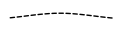 | Facilities - Ramp - Below Water | RampBelowWater | 120320 | Line | 150046000012032000000000000000 |
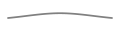 | Shoreline Protection - Breakwater/Groin/Jetty - Above Water | BreakwaterAboveWater | 120326 | Line | 150046000012032600000000000000 |
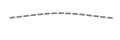 | Shoreline Protection - Breakwater/Groin/Jetty - Below Water | BreakwaterBelowWater | 120327 | Line | 150046000012032700000000000000 |
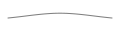 | Shoreline Protection - Seawall | Seawall | 120328 | Line | 150046000012032800000000000000 |
Aids to navigation
| Graphic | Name | Entity | Geometry | SIDC | |
|---|---|---|---|---|---|
 | Aids to Navigation - Beacon | Beacon | 120401 | Point | 150046000012040100000000000000 |
 | Aids to Navigation - Buoy Default | BuoyDefault | 120402 | Point | 150046000012040200000000000000 |
 | Aids to Navigation - Marker | Marker | 120403 | Point | 150046000012040300000000000000 |
 | Aids to Navigation - Perches/Stakes - Point | PerchesStakesPoint | 120404 | Point | 150046000012040400000000000000 |
 | Aids to Navigation - Light | NavigationLight | 120406 | Point | 150046000012040600000000000000 |
 | Aids to Navigation - Light Vessel/Light Ship | LightVessel | 120408 | Point | 150046000012040800000000000000 |
 | Aids to Navigation - Lighthouse | Lighthouse | 120409 | Point | 150046000012040900000000000000 |
 | Aids to Navigation - Perches/Stakes - Area | PerchesStakesArea | 120405 | Area | 150046000012040500000000000000 |
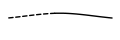 | Aids to Navigation - Leading Line | LeadingLine | 120407 | Line | 150046000012040700000000000000 |
Dangers and hazards
| Graphic | Name | Entity | Geometry | SIDC | |
|---|---|---|---|---|---|
 | Dangers/Hazards - Rock Submerged | RockSubmerged | 120501 | Point | 150046000012050100000000000000 |
 | Dangers/Hazards - Rock Awashed | RockAwashed | 120502 | Point | 150046000012050200000000000000 |
 | Dangers/Hazards - Foul Ground - Point | FoulGroundPoint | 120504 | Point | 150046000012050400000000000000 |
 | Dangers/Hazards - Kelp/Seaweed - Point | KelpPoint | 120506 | Point | 150046000012050600000000000000 |
 | Dangers/Hazards - Snags/Stumps | SnagsStumps | 120508 | Point | 150046000012050800000000000000 |
 | Dangers/Hazards - Wreck (Uncovers) | WreckUncovers | 120509 | Point | 150046000012050900000000000000 |
 | Dangers/Hazards - Wreck (Submerged) | WreckSubmerged | 120510 | Point | 150046000012051000000000000000 |
 | Dangers/Hazards - Eddies/Overfalls/Tide Rips | EddiesOverfalls | 120513 | Point | 150046000012051300000000000000 |
 | Dangers/Hazards - Underwater Danger/Hazard | UnderwaterDanger | 120503 | Area | 150046000012050300000000000000 |
 | Dangers/Hazards - Foul Ground - Area | FoulGroundArea | 120505 | Area | 150046000012050500000000000000 |
 | Dangers/Hazards - Kelp/Seaweed - Area | KelpArea | 120507 | Area | 150046000012050700000000000000 |
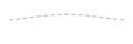 | Dangers/Hazards - Breakers | Breakers | 120511 | Line | 150046000012051100000000000000 |
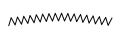 | Dangers/Hazards - Reef | Reef | 120512 | Line | 150046000012051200000000000000 |
 | Dangers/Hazards - Discolored Water | DiscoloredWater | 120514 | Area | 150046000012051400000000000000 |
Bottom features
| Graphic | Name | Entity | Geometry | SIDC | |
|---|---|---|---|---|---|
 | Bottom Characteristics - Sand | BottomSand | 120601 | Point | 150046000012060100000000000000 |
 | Bottom Characteristics - Mud | BottomMud | 120602 | Point | 150046000012060200000000000000 |
 | Bottom Characteristics - Clay | BottomClay | 120603 | Point | 150046000012060300000000000000 |
 | Bottom Characteristics - Silt | BottomSilt | 120604 | Point | 150046000012060400000000000000 |
 | Bottom Characteristics - Stones | BottomStones | 120605 | Point | 150046000012060500000000000000 |
 | Bottom Characteristics - Gravel | BottomGravel | 120606 | Point | 150046000012060600000000000000 |
 | Bottom Characteristics - Pebbles | BottomPebbles | 120607 | Point | 150046000012060700000000000000 |
 | Bottom Characteristics - Cobbles | BottomCobbles | 120608 | Point | 150046000012060800000000000000 |
 | Bottom Characteristics - Rock | BottomRock | 120609 | Point | 150046000012060900000000000000 |
 | Bottom Characteristics - Coral | BottomCoral | 120610 | Point | 150046000012061000000000000000 |
 | Bottom Characteristics - Shell | BottomShell | 120611 | Point | 150046000012061100000000000000 |
 | Qualifying Terms - Fine | QualifyingFine | 120612 | Point | 150046000012061200000000000000 |
 | Qualifying Terms - Medium | QualifyingMedium | 120613 | Point | 150046000012061300000000000000 |
 | Qualifying Terms - Coarse | QualifyingCoarse | 120614 | Point | 150046000012061400000000000000 |
Tide and current
| Graphic | Name | Entity | Geometry | SIDC | |
|---|---|---|---|---|---|
 | Tide and Current - Water Turbulence | WaterTurbulence | 120701 | Point | 150046000012070100000000000000 |
 | Tide and Current - Tide Data Point | TideDataPoint | 120704 | Point | 150046000012070400000000000000 |
 | Tide and Current - Tide Gauge | TideGauge | 120705 | Point | 150046000012070500000000000000 |
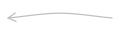 | Tide and Current - Current Flow - Ebb | CurrentFlowEbb | 120702 | Line | 150046000012070200000000000000 |
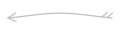 | Tide and Current - Current Flow - Flood | CurrentFlowFlood | 120703 | Line | 150046000012070300000000000000 |
Man-made structures
| Graphic | Name | Entity | Geometry | SIDC | |
|---|---|---|---|---|---|
 | Man-Made Structures - Ford | Ford | 160400 | Point | 150046000016040000000000000000 |
 | Man-Made Structures - Lock | Lock | 160500 | Point | 150046000016050000000000000000 |
 | Man-Made Structures - Oil/Gas Rig | OilGasRig | 160600 | Point | 150046000016060000000000000000 |
 | Man-Made Structures - Pile/Piling/Post | PilePost | 160900 | Point | 150046000016090000000000000000 |
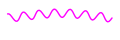 | Man-Made Structures - Submarine Cable | SubmarineCable | 160100 | Line | 150046000016010000000000000000 |
 | Man-Made Structures - Submerged Crib | SubmergedCrib | 160200 | Area | 150046000016020000000000000000 |
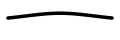 | Man-Made Structures - Canal | Canal | 160300 | Line | 150046000016030000000000000000 |
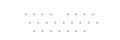 | Man-Made Structures - Oil/Gas Rig Field | OilGasRigField | 160700 | Area | 150046000016070000000000000000 |
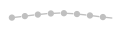 | Man-Made Structures - Pipelines/Pipe | Pipeline | 160800 | Line | 150046000016080000000000000000 |
Bioluminescence
| Graphic | Name | Entity | Geometry | SIDC | |
|---|---|---|---|---|---|
 | Bioluminescence - VDR Level 1-2 | VdrLevel1to2 | 130101 | Area | 150046000013010100000000000000 |
 | Bioluminescence - VDR Level 2-3 | VdrLevel2to3 | 130102 | Area | 150046000013010200000000000000 |
 | Bioluminescence - VDR Level 3-4 | VdrLevel3to4 | 130103 | Area | 150046000013010300000000000000 |
 | Bioluminescence - VDR Level 4-5 | VdrLevel4to5 | 130104 | Area | 150046000013010400000000000000 |
 | Bioluminescence - VDR Level 5-6 | VdrLevel5to6 | 130105 | Area | 150046000013010500000000000000 |
 | Bioluminescence - VDR Level 6-7 | VdrLevel6to7 | 130106 | Area | 150046000013010600000000000000 |
 | Bioluminescence - VDR Level 7-8 | VdrLevel7to8 | 130107 | Area | 150046000013010700000000000000 |
 | Bioluminescence - VDR Level 8-9 | VdrLevel8to9 | 130108 | Area | 150046000013010800000000000000 |
 | Bioluminescence - VDR Level 9-10 | VdrLevel9to10 | 130109 | Area | 150046000013010900000000000000 |
Beach slope
| Graphic | Name | Entity | Geometry | SIDC | |
|---|---|---|---|---|---|
 | Beach Slope - Flat | BeachSlopeFlat | 130201 | Area | 150046000013020100000000000000 |
 | Beach Slope - Gentle | BeachSlopeGentle | 130202 | Area | 150046000013020200000000000000 |
 | Beach Slope - Moderate | BeachSlopeModerate | 130203 | Area | 150046000013020300000000000000 |
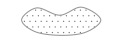 | Beach Slope - Steep | BeachSlopeSteep | 130204 | Area | 150046000013020400000000000000 |
Mine warfare bottom descriptors
| Graphic | Name | Entity | Geometry | SIDC | |
|---|---|---|---|---|---|
 | MIW Bottom Sediments - Solid Rock | MiwSolidRock | 140101 | Area | 150046000014010100000000000000 |
 | MIW Bottom Sediments - Clay | MiwClay | 140102 | Area | 150046000014010200000000000000 |
 | MIW Bottom Sediments - Very Coarse Sand | MiwVeryCoarseSand | 140103 | Area | 150046000014010300000000000000 |
 | MIW Bottom Sediments - Coarse Sand | MiwCoarseSand | 140104 | Area | 150046000014010400000000000000 |
 | MIW Bottom Sediments - Medium Sand | MiwMediumSand | 140105 | Area | 150046000014010500000000000000 |
 | MIW Bottom Sediments - Fine Sand | MiwFineSand | 140106 | Area | 150046000014010600000000000000 |
 | MIW Bottom Sediments - Very Fine Sand | MiwVeryFineSand | 140107 | Area | 150046000014010700000000000000 |
 | MIW Bottom Sediments - Very Fine Silt | MiwVeryFineSilt | 140108 | Area | 150046000014010800000000000000 |
 | MIW Bottom Sediments - Fine Silt | MiwFineSilt | 140109 | Area | 150046000014010900000000000000 |
 | MIW Bottom Sediments - Medium Silt | MiwMediumSilt | 140110 | Area | 150046000014011000000000000000 |
 | MIW Bottom Sediments - Coarse Silt | MiwCoarseSilt | 140111 | Area | 150046000014011100000000000000 |
 | MIW Bottom Sediments - Boulders | MiwBoulders | 140112 | Area | 150046000014011200000000000000 |
 | MIW Bottom Sediments - Cobbles, Oyster Shells | MiwCobblesOysterShells | 140113 | Area | 150046000014011300000000000000 |
 | MIW Bottom Sediments - Pebbles, Shells | MiwPebblesShells | 140114 | Area | 150046000014011400000000000000 |
 | MIW Bottom Sediments - Sand and Shells | MiwSandAndShells | 140115 | Area | 150046000014011500000000000000 |
 | MIW Bottom Sediments - Land | MiwLand | 140116 | Area | 150046000014011600000000000000 |
 | MIW Bottom Sediments - No Data | MiwNoData | 140117 | Area | 150046000014011700000000000000 |
 | Bottom Roughness - Smooth | MiwRoughnessSmooth | 140118 | Area | 150046000014011800000000000000 |
 | Bottom Roughness - Moderate | MiwRoughnessModerate | 140119 | Area | 150046000014011900000000000000 |
 | Bottom Roughness - Rough | MiwRoughnessRough | 140120 | Area | 150046000014012000000000000000 |
 | Clutter (Bottom) - Low | MiwClutterLow | 140121 | Area | 150046000014012100000000000000 |
 | Clutter (Bottom) - Medium | MiwClutterMedium | 140122 | Area | 150046000014012200000000000000 |
 | Clutter (Bottom) - High | MiwClutterHigh | 140123 | Area | 150046000014012300000000000000 |
 | Impact Burial - 0% | MiwImpactBurial0 | 140124 | Area | 150046000014012400000000000000 |
 | Impact Burial - 0-10% | MiwImpactBurial0to10 | 140125 | Area | 150046000014012500000000000000 |
 | Impact Burial - 10-20% | MiwImpactBurial10to20 | 140126 | Area | 150046000014012600000000000000 |
 | Impact Burial - 20-75% | MiwImpactBurial20to75 | 140127 | Area | 150046000014012700000000000000 |
 | Impact Burial - >75% | MiwImpactBurialOver75 | 140128 | Area | 150046000014012800000000000000 |
 | MIW Bottom Category - A | MiwCategoryA | 140129 | Area | 150046000014012900000000000000 |
 | MIW Bottom Category - B | MiwCategoryB | 140130 | Area | 150046000014013000000000000000 |
 | MIW Bottom Category - C | MiwCategoryC | 140131 | Area | 150046000014013100000000000000 |
 | MIW Bottom Type - A1 | MiwTypeA1 | 140132 | Area | 150046000014013200000000000000 |
 | MIW Bottom Type - A2 | MiwTypeA2 | 140133 | Area | 150046000014013300000000000000 |
 | MIW Bottom Type - A3 | MiwTypeA3 | 140134 | Area | 150046000014013400000000000000 |
 | MIW Bottom Type - B1 | MiwTypeB1 | 140135 | Area | 150046000014013500000000000000 |
 | MIW Bottom Type - B2 | MiwTypeB2 | 140136 | Area | 150046000014013600000000000000 |
 | MIW Bottom Type - B3 | MiwTypeB3 | 140137 | Area | 150046000014013700000000000000 |
 | MIW Bottom Type - C1 | MiwTypeC1 | 140138 | Area | 150046000014013800000000000000 |
 | MIW Bottom Type - C2 | MiwTypeC2 | 140139 | Area | 150046000014013900000000000000 |
 | MIW Bottom Type - C3 | MiwTypeC3 | 140140 | Area | 150046000014014000000000000000 |
Maritime limits
| Graphic | Name | Entity | Geometry | SIDC | |
|---|---|---|---|---|---|
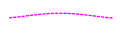 | Limits - Maritime Limit Boundary | MaritimeLimitBoundary | 150100 | Line | 150046000015010000000000000000 |
 | Limits - Maritime Area | MaritimeArea | 150200 | Area | 150046000015020000000000000000 |
 | Limits - Restricted Area | RestrictedArea | 150300 | Line | 150046000015030000000000000000 |
 | Limits - Swept Area | SweptArea | 150400 | Area | 150046000015040000000000000000 |
 | Limits - Training Area | TrainingArea | 150500 | Area | 150046000015050000000000000000 |
 | Limits - Operator-Defined | OperatorDefinedMaritimeArea | 150600 | Area | 150046000015060000000000000000 |
Marine weather warnings (S-412)
| Graphic | Name | Entity | Geometry | SIDC | |
|---|---|---|---|---|---|
 | Significant Wave Height Warning - 2.5 to 4 m | S412WaveWarning2To4m | — | Area | none |
 | Significant Wave Height Warning - 4 to 6 m | S412WaveWarning4To6m | — | Area | none |
 | Significant Wave Height Warning - 6 to 9 m | S412WaveWarning6To9m | — | Area | none |
 | Significant Wave Height Warning - 9 to 14 m | S412WaveWarning9To14m | — | Area | none |
 | Significant Wave Height Warning - Over 14 m | S412WaveWarningOver14m | — | Area | none |
 | Ice Accretion Warning - Moderate Icing | S412IceAccretionModerate | — | Area | none |
 | Ice Accretion Warning - Severe Icing | S412IceAccretionSevere | — | Area | none |
Ice charts (S-411)
| Graphic | Name | Entity | Geometry | SIDC | |
|---|---|---|---|---|---|
 | Sea Ice Concentration - Ice Free | S411IceFree | — | Area | none |
 | Sea Ice Concentration - Open Water (less than 1/10) or Bergy Water | S411OpenWater | — | Area | none |
 | Sea Ice Concentration - Very Open Drift (1/10 to 3/10) | S411VeryOpenDrift | — | Area | none |
 | Sea Ice Concentration - Open Drift (4/10 to 6/10) | S411OpenDrift | — | Area | none |
 | Sea Ice Concentration - Close Pack (7/10 to 8/10) | S411ClosePack | — | Area | none |
 | Sea Ice Concentration - Very Close Pack (9/10 to 10/10) | S411VeryClosePack | — | Area | none |
 | Sea Ice Concentration - Compact or Consolidated (10/10) | S411CompactIce | — | Area | none |
 | Sea Ice Concentration - Undetermined | S411ConcentrationUnknown | — | Area | none |
 | Stage of Development - Ice Free, Brash or None | S411StageIceFree | — | Area | none |
 | Stage of Development - New Ice (less than 10 cm) | S411NewIce | — | Area | none |
 | Stage of Development - Nilas, Ice Rind (less than 10 cm) | S411Nilas | — | Area | none |
 | Stage of Development - Young Ice (10 to 30 cm) | S411YoungIce | — | Area | none |
 | Stage of Development - Grey Ice (10 to 15 cm) | S411GreyIce | — | Area | none |
 | Stage of Development - Grey-White Ice (15 to 30 cm) | S411GreyWhiteIce | — | Area | none |
 | Stage of Development - First-Year Ice (30 to 200 cm) | S411FirstYearIce | — | Area | none |
 | Stage of Development - Thin First-Year Ice (30 to 70 cm) | S411ThinFirstYearIce | — | Area | none |
 | Stage of Development - Thin First-Year Ice, Stage 1 (30 to 50 cm) | S411ThinFirstYearStage1 | — | Area | none |
 | Stage of Development - Thin First-Year Ice, Stage 2 (50 to 70 cm) | S411ThinFirstYearStage2 | — | Area | none |
 | Stage of Development - Medium First-Year Ice (70 to 120 cm) | S411MediumFirstYearIce | — | Area | none |
 | Stage of Development - Thick First-Year Ice (over 120 cm) or Residual Ice | S411ThickFirstYearIce | — | Area | none |
 | Stage of Development - Old Ice | S411OldIce | — | Area | none |
 | Stage of Development - Second-Year Ice | S411SecondYearIce | — | Area | none |
 | Stage of Development - Multi-Year Ice | S411MultiYearIce | — | Area | none |
 | Stage of Development - Glacier Ice (Icebergs) | S411GlacierIce | — | Area | none |
 | Stage of Development - Undetermined | S411StageUnknown | — | Area | none |
 | Iceberg Area | S411IcebergArea | — | Area | none |
 | Ice Keel/Bummock | S411IceKeel | — | Point | none |
 | Grounded Hummock | S411GroundedHummock | — | Point | none |
 | Strips and Patches | S411StripsAndPatches | — | Point | none |
 | Stage of Melt | S411StageOfMelt | — | Point | none |
 | Ice Lead | S411IceLeadPoint | — | Point | none |
 | Ice Fracture | S411IceFracturePoint | — | Point | none |
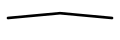 | Ice Edge | S411IceEdge | — | Line | none |
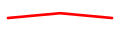 | Limit of Open Water | S411LimitOfOpenWater | — | Line | none |
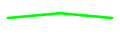 | Limit of All Known Ice | S411LimitOfAllKnownIce | — | Line | none |
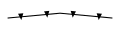 | Iceberg Limit | S411IcebergLimit | — | Line | none |
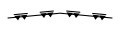 | Line of Ice Ridge | S411IceRidgeLine | — | Line | none |
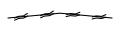 | Line of Ice Lead | S411IceLeadLine | — | Line | none |
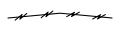 | Line of Ice Fracture | S411IceFractureLine | — | Line | none |
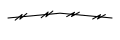 | Line of Ice Crack | S411IceCrackLine | — | Line | none |